Project: InaSAFE
Version: 4.3.0
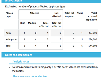
It is now possible to assign populations to places and carry out an analysis of affected places with populations included in the report. This is useful when, for example, generating an earthquake impact report you can now show affected places on their populations.
See : https://github.com/inasafe/inasafe/issues/4592 and https://github.com/inasafe/inasafe/issues/4483