Project: InaSAFE
Version: 4.0.0
In all versions prior to Version 4.0, we made heavy use of interpolation in order to determine whether buildings or other exposure layers are impacted. Whist this is a commonly used technique in GIS, it often leads to non-intuitive looking reports. Here is an example from the old version (see issue #1083:
Under our new architecture, we always use geometric overlay operations to make a determination whether an exposure feature is affected or not. The implication of this is that we produce intuitive and easily verifiable impact layers. You can see an example here:
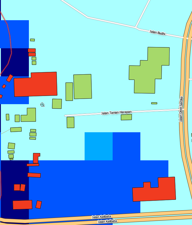
Another important improvement is the fact that the determination of what hazard level each exposure feature is assigned is based on the highest hazard that it touches. In older versions, it was indeterminate what the behaviour would be if, for example, a building touches two different zones of hazard level. Under InaSAFE 4.0 an exposure feature will always be assigned the highest hazard level that it touches. So if for example a building is partially flooded, it will always be considered to be flooded, even if another part touches a non-flooded area.
This feature was funded by DFAT & WB/GFDRR