

Using remote services in GeoNode
“GeoNode can be configured to consume standards compliant remote services and add them as GeoNode Layers”
GeoNode allows platform administrators to configure a variety of standards-compliant remote services that can be integrated into GeoNode, allowing the data provided from those services to be published and consumed directly from GeoNode.
This allows GeoNode to be Federated with other services, which means that GeoNode users may access data that is managed by other agencies or providers from within the platform. GeoNode currently supports the following Service Types:
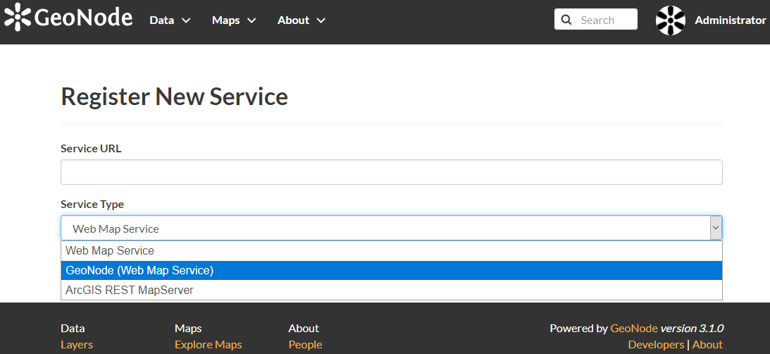
- Web Map Service: Generic OGC WMS services are supported
- GeoNode Web Map Service: This service is specific to other instances of the GeoNode platform and contains certain optimizations over generic WMS connections
- ArcGIS REST MapServer: GeoNode will access ArcGIS servers via REST and consume the available services
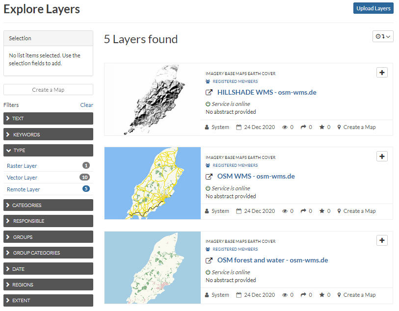
GeoNode will automatically scan the service and identify any available layers which can be consumed. Each resource that is selected and imported will immediately become available as a GeoNode layer. These layers can have typical GeoNode functionalities applied including permissions and metadata records, and have their own Remote Layer filter available from within the layer navigation interface. These layers may then be used directly by users for creating maps and other content.
You try:
Goal: To add a remote service to GeoNode
Adding a remote service
- Navigate to the Remote Services section from the Data menu
- Review the available services and ensure that the service you are trying to upload does not already exist
- Select Register a new Service
- Add the URL to your WMS service provider, such as
https://ows.terrestris.de/osm/service,https://demo.geo-solutions.it/geoserver/wms, orhttps://maps.heigit.org/osm-wms/service?SERVICE=WMS - Select the relevant service type and click Create
- Add the resources you wish to add by using the available checkboxes
- Select Import Resources to add the resources as new GeoNode layers
Once you have added the relevant resources to GeoNode, you will be able to find them from the available layers interface by using the Remote Service Type filter. Each remote service layer can then be managed like other GeoNode resources and have its permissions and metadata altered, or it may be added to a new map.
More about Remote Services
Remote service support is not only useful for externally managed services, but is useful for the publication of local data as well, such as the publication of a database view from a local datasource. By coupling a database such as PostgreSQL/ PostGIS with an OGC compliant geodata server like Geoserver, MapServer, or QGIS Server, users can publish and manage their local data using the GeoNode platform.
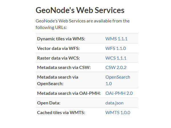
GeoNode utilizes PostGIS and Geoserver as backend services. This means that each GeoNode instance is fully capable of serving remote services itself, it only needs to have the service configuration applied from within the Geoserver interface by a system administrator. Once this has been completed, the GeoNode instance may be added to another GeoNode instance as a remote service, or those services may be utilised from other applications which support OGC service sources, such as QGIS Desktop.
The web addresses to access your GeoNode data will typically resemble the format http://your.geonode.tld/geoserver/ows? along with the relevant suffix for your service type. By default, these services are published on GeoNode and can be accessed from the Developers link in the interface footer area, or by navigating to http://your.geonode.tld/developer/.
An example of one of the services would look like http://your.geonode.tld/geoserver/ows?service=WMS&version=1.1.1&request=GetCapabilities, which should return a valid XML response when loaded into a web browser.

Check your knowledge:
-
What remote service types does GeoNode support:
- All OGC and ArcGIS services
- WMS, WFS, CSW and ArcGIS REST
- WMS and ArcGIS REST MapServer services
-
True or false, only system adminstrators can add remote services:
- True, regular users do not have the permissions to add remote service layers
- False, regular users may add remote service layers but adminstrators can disable this functionality
- True, regular users may add any remote service layers as long as they are from publicly accessible sources

Further reading:
-
Publishing a PostGIS view to GeoNode with QGIS server https://www.youtube.com/watch?v=73VzX7zuabw