

About metadata in GeoNode
“Metadata is data about data”
Metadata summarizes basic information about data, making finding and working with particular instances and versions of data easier. It describes various characteristics of the data such as the title, abstract, author, and keywords. When spatial data and other resources are published to GeoNode, the instance of that resource is tied to a particular set of metadata attributes. GeoNode provides various tools for viewing and managing metadata, and has the ability to generate metadata as well as providing the functionality required to allow users to populate and edit it, as well as allowing exports of metadata in various standards compliant formats.

You try:
Goal: To explore metadata capabilities in GeoNode
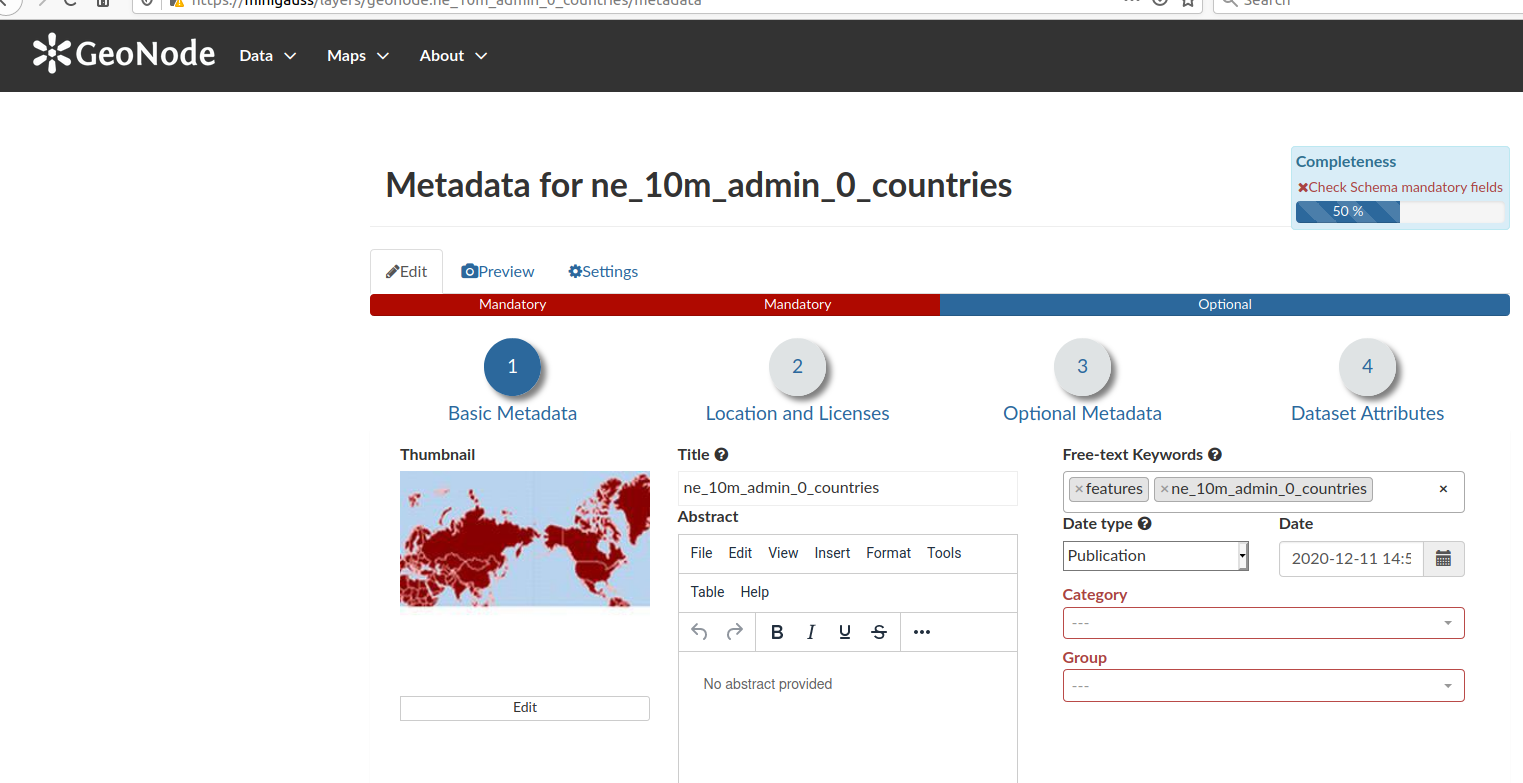
Exercise 01 - Using the GeoNode Metadata Wizard
- Select a layer from the listed layers in GeoNode
- Navigate to the editing properties of your layer
- Use the Metadata Wizard available from the Metadata Tools
- Step through the wizard complete all of the mandatory fields
- Check on the metadata completeness level indicator
- After completing each tab, you can navigate between edit mode and preview mode to visualize updates
Some important metadata fields include:
- Title - a user friendly layer name for a resource.
- Regions - depict the spatial coverage of the vector layers.
- Group Permissions - which groups have permission to access the recource
- Licencing - the type of licencing for the resource
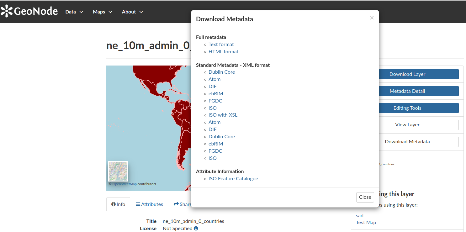
Exercise 02 - Additional Metadata Actions
- Update a layers metadata by manually editing the layer metadata
- Update a layers metadata using the metadata upload feature
Check your results
For each layer, ensure that you have added the relevant metadata and inspect the download options available for it. Note that metadata can be captured for any resource that is uploaded to GeoNode, including maps and documents.
| Name | Expectation |
|---|---|
Metadata Tools |
Wizard, Advanced Edit and Upload Metadata |
Metadata Format |
Atom, DIF, Dublin Core, ISO, ISO with XSL etc |
Metadata File |
XML in ISO 19115 format |
More about layer metadata
Richly populated metadata is important for many reasons, some of which include:
- Recording data provenance
- Recording the processing history
- Noting the correct attribution for license compliance
- Providing details of any access constraints
- Providing web service access URLs and data endpoints
- Providing contact information
- Being interoperable with other ISO 19115 compliant metadata systems
- Complying with regulations and policies, such as the INSPIRE Directive in Europe

Check your knowledge:
-
Which statement is false regarding metadata standards:
- It helps users to understand the data characteristics
- To ease sharing between different software
- To ensure data management policy compliance
-
Metadata generated from other platforms, such as the QGIS MetaTools plugin, can be ingested in GeoNode despite being produced with different toolsets. Why is that?:
- The metadata contains Keywords and this allows them to be used in GeoNode
- GeoNode does not care about the contents and structure as long as the metadata file has the extension (.xml)
- They all produce metadata that adhere to some common standard
